Advances in Topographic Mapping – Conference 27-28 October 2022

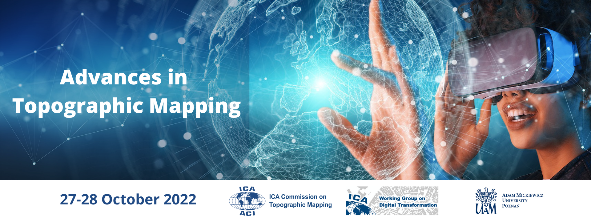
The ongoing development of technologies and datasets present new challenges and opportunities for producers and users of topographic mapping. In particular, AI and machine learning present new methods for facilitating the design and production of topographic maps, while AR/VR offer new possibilities for users to engage with topographic data. This virtual conference aims to provide a forum for national mapping organisations and academic researchers to discuss the strategic implementation of these technologies and to explore their potential. This includes the  use of open-source data for national mapping and the creation of new topographic products, such as immersive virtual geographic environments. The conference offers a forum for national mapping organisations and academic researchers to address key issues in the utilisation of new technologies and to explore opportunities for collaboration, particularly for establishing best practice and a relevant research agenda.

The conference is organised jointly by the ICA Commission on Topographic Mapping, the ICA Working Group on Digital Transformation of National Mapping Agencies and the Adam Mickiewicz University in Poznań.

Conference Topics

  • Topographic Mapping and Immersive Virtual Environments (IVE)
  • Utilising Open-Source Data in Topographic Mapping
  • Developments in Topographic Map Production
  • Enhancing user experience of, and trust in, topographic maps

Programme

Explore the full conference programme here.

Registration

The registration fee for the conference is 50 EUR (25 EUR for Students). Please click here to register online. Deadline for registration: 21 October 2022.

Keynote speaker

Mark Cygan – Esri’s Director of National Mapping Solutions. Mark is actively participating in the; United Nations Committee of Experts on Global Geospatial Information Management (UN-GGIM), UN-GGIM Geospatial Societies Board Member (and past Chair), User Community of Geospatial Authorities Executive Secretary and on the International Map Industry Association (IMIA) Board of Directors and chair of their Programs Committee (Events, Affiliation Partnerships and Awards)

Contact

If you have any questions regarding the conference, please get in touch with the local organiser, Dr Łukasz Halik (Vice-Chair of the ICA Commission on Topographic Mapping) via email: topovicechair(at)icaci.org

Pre-ICC Workshop on Cartography as a Cultural Encounter: How East and West have Mapped and Influenced Each Other

The ICA Commission on the History of Cartography and ICA Commission on Topographic Mapping take pleasure in inviting you to their jointly organised workshop held before the 29th International Cartographic Conference on 15 July 2019.

Location: National Museum of Emerging Science and Innovation (Miraikan), Room Uranus

Final Programme

Please check the workshop website for updates.

  • 10:00–10:15 Walk in with coffee/tea
  • 10:15–10:30 Opening address by the organizers 

Session I – Eastern Cartographic Practices and their Echo in the West

  • 10:30–11:05 World image of early modern Japan, Professor Hirotada Kawamura
  • 11:05–11:40 Early modern maps of Japan as sources of Western cartography of East Asia during the 18th and 19th century, Professor Shigeru Kobayashi
  • 11:40–12:15 Early Chinese Bronze Ritual Vessel Cartography: How Trees, Mounds, Spirals, and Ponds Were Used to Document Early China’s Landscape, Bruce Jones

12:15–13:30 Lunch break (on your own)

Session II – From Tradition to Modernity: Diverse Cartographic Cultures in India

  • 13:30–14:05 Cartographic history of India: Mapping India from the early modern ages till 20th century, Ankita Medhi
  • 14:05–14:40 The role of cartography in tiger conservation of Ranthambhore Tiger Reserve, India, Bhanwar Vishvendra Raj Singh

14:40–15:00 Coffee break

Session III – Between the Old and The New World: A Cartographic Encounter

  • 15:00–15:35 How East and West Cartographic Studies Influenced the Most Important 16th Century Ottoman Cartographer of Piri Reis and His World Maps, Aytaç Yürükçü
  • 15:35–16.05 Jesuit View of Americas: A Cultural Encounter in the New World, Mirela Altić
  • 16:05–16:15 Closing remarks

Map Exhibitions

Two exhibitions concerned with the history of cartography are being held during the ICC in Tokyo. The first is an exhibit at the National Diet Library (NDL) located in the central part of Tokyo. On display are seven sets of maps which were selected from the collection of NDL as notable examples of Japanese early modern maps. Second is a special exhibition of maps of Japan by Sekisui Nagakubo (1717-1801) focusing on the role of his maps in the transition of the Western geographical image of Japan when they were brought to Europe. The exhibit is being held at the Koga Historical Museum, Koga City, Ibaraki Prefecture.

Both exhibitions are announced on the ICC homepage as Technical Visits on Wednesday 17 July as T-Course B. For more information on the exhibitions see http://www.icc2019.org/technical_visits.html

Please find more information on the workshop website: history.icaci.org/tokyo-2019

Mapping Empires – Thank you for an interesting symposium!

The ICA Commission on Topographic Mapping joined forces with the ICA Commission on the History of Cartography to organise Mapping Empires: Colonial Cartographies of Land and Sea in Oxford from 13th to 15th September 2018. Over 60 delegates from around the world took part in this very special event, which was hosted by the city’s Bodleian Libraries. A wide range of superb presentations gave new insights on topographic mapping initiatives and colonial cartography and brought new perspectives on their legacy. The proceedings will be published next year in a special volume by Springer. Such was the success of the partnership that the Commissions are already planning a pre-conference workshop for Tokyo in 2019. Updates will be available soon.

Special Issue of The Cartographic Journal – Call for Papers

The Commission invites papers for a Special Issue of The Cartographic Journal that is planned for November 2018 entitled “Topographic Mapping: Past, Present and Future”. Contributions may involve research on any aspect of topographic mapping and are especially encouraged from providers, from national and multi-national mapping organisations to community mapping groups. In particular, we welcome submissions relating to the following topics:

  • Advances in production techniques
  • Initiatives for topographic data interoperability and harmonisation
  • History of topographic mapping
  • Relevance and use of topographic maps
  • National styles of cartography
  • New methods of portrayal, especially involving non-representational approaches

A title and abstract of no more than 200 words should be sent to Dr Alex Kent or Dr Anja Hopstock by 1st March 2018 (deadline extended!). Full papers will be from 4000-8000 words and notification of acceptance will be made to all authors by 30th April 2018.


Mapping Empires – Call for Papers

Dear Commission Members and Map Friends,

Please find attached the Call for Papers for the international symposium ‘Mapping Empires: Colonial Cartographies of Land and Sea’, which will be held from 13 to 15 September 2018 in Oxford (UK) and is jointly organised by the Commission on the History of Cartography together with the ICA Commission on Topographic Mapping and the Bodleian Libraries of the University of Oxford.

Call for Papers – Mapping Empires

For more information you can also visit the symposium website at http://mappingempires.icaci.org/


Activities at ICC2017

Dear all,

ICC 2017 is approaching. In 3 weeks from now cartographers from around the world are gathering in Washington to discuss history, present and future of cartography.

There are several activities dedicated to Topographic Mapping:

  • The pre-conference workshop “Maps & Emotions” has been jointly organized by 3 commissions and is exploring further the relationships between maps, emotions and places.
  • Please reserve Wed July 5th as the Topographic Mapping day. The following sessions might be of interest to you!
    • 8:30 AM – 10:00 AM Location: Maryland C
      Latest developments in National Mapping
    • 12:30 PM – 1:20 PM Location: Virginia A
      We invite all interested colleagues to join us for the business meeting of our commission to learn how to get involved in the activities and for making new plans.
    • 1:30 PM – 1:50 PM Location: Virginia A  Research in Topographic Mapping
    • 2:50 PM – 3:10 PM Location: Virginia A New initiatives in Topographic Mapping
    • 3:50 PM – 6:50 PM Poster session F

Looking forward seeing you there,

Alex and Anja


10th Mountain Cartography Workshop

The Carl von Stahl Haus, a mountain hut lying 1,736m high among the breathtaking Berchtesgaden Alps and just over the border into Austria, was the venue for the 10th Mountain Cartography workshop from 26th to 30th April 2016, organised by the ICA Commission on Mountain Cartography. The event attracted around 50 delegates from around the world and combined a full programme of presentations with opportunities to explore the landscape as the weather improved. Our two ICA Commissions (Topographic Mapping and Mountain Cartography) discussed plans for a joint workshop to be held at the forthcoming ICC2017 in Washington, D.C. cmc_2016_group